


DJI officially released 2.4G Bluetooth Datalink & iPAD Ground Station.
Important: The map of Mainland China downloaded from Mainland China IP addresses has differences with the actual geographic environments. If users download the map of Mainland China from foreign IP addresses, which will be more accurate.
2.4G Bluetooth Datalink Functions

- 1. Provides communications between the Ground end and the Air end using the DJI bidirectional data communication modules; the iPAD Ground Station communicates with the Ground end using the BTU module;
- 2. Use the 2.4G Bluetooth Datalink Assistant Software to upgrade the firmware of the 2.4G Bluetooth Datalink and the BTU module;
- 3.Provides bidirectional communications with large dataflow within the specified distance of the remote control.
iPAD Ground Station Functions


- 1. Friendly interface design;
- 2. Joystick control on touch screen;
- 3. Single waypoint function, click desired point and go;
- 4. Waypoints function, edit a routine and go;
- 5. Flight route template;
- 6. Editable Home point & auto Go Home supported;
- 7. One key takeoff & landing;
- 8. Flight simulator supported;
- 9. Customized joystick mode supported;
- 10. Accurate flight time monitoring;
- 11. Three map orientations setting;
- 12. Voice guidance function;
- 13. Real-time alarming function;
- 14. Routes saving and reloading supported;
- 15. Chinese and English UI supported;
- 16. Cloud Storage supported;
Flight control systems supported:
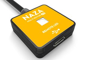
2.4G Bluetooth Datalink: ACE ONE, WKM, NAZA-M, NAZA-M V2;
iPAD Ground Station: WKM, NAZA-M, NAZA-M V2;
Note:
- All the firmware of the flight control systems should be upgraded to the latest version.
- The firmware of NAZA-M and NAZA-M V2 should be upgraded to version 4.00, which is coming soon.

2.4G Bluetooth DataLink Setup Tutorial

iPad Ground Station Function Demonstration

iPad Ground Station Outdoor Flight

iPad Ground Station Beyond Visual Range(BVR) Flight
 Flight")
Please click here for more information.
Specialized Station Of Multirotor autopilot system
The Wongkong-M Waypoint Ground Station is the upgraded version of the Wongkong-M Single Waypoint Ground Station. It improves the function of way point editing for the ground control station. The line of DJI waypoint products provides waypoint mode, F channel controller, general purpose servo action, and 6 route templates. The maximum way points that could be added are twenty. It also supports the changing and editing of the flight route before or during the fight.

Reliable Datalink
DJI offers 2.4Ghz and 900MHz datalink to achieve long-range two-way communication. The datalink maximum distance is up to 15km. The ground end also links with USB power supply that is convenient for outdoor use. The wireless module uses FHSS technology which is verified by FCC and CE certification, DJI datalink has many advantages such as: high data rate, stable performance, strong anti-interference capability, and long communication distance. The 2.4GHz datalink’s power consumption is 550mw and 900MHz datalink 1.5W, which is big advantage for long-distance flight missions.

Industrial Flight Control Algorithm
The entire ground control system combines GPS 6DOF inertial measurement unit, magnetometer, and pressure altimeter sensors to optimize robustness of algorithms and robotic control logics. Ground control system utilizes advanced GPS/INS proprietary algorithm technology in the entire design. Even in adverse conditions, high vibration and high demand environments, the helicopter maintains flight stability accurately to ensure mission success rate.

Quick GPS Acquisition / Simple Compass Calibration
System design and use of high grade components enables fast GPS acquisition time. Compass calibration with 45° tolerance is easier and faster than previous models.

Google 3D Map
DJI Ground Station designed around intuitive Google 3D map offering GIS data. Pilot can operate and plan flight routes anywhere, use PC mouse to zoom in/out of 3D Maps which can be downloaded to PC and used elsewhere in offline mode.

Real-time flight Monitoring
In addition to the aircraft location, heading and altitude, our ground station also provides other flight data such as attitude, air speed, vertical speed, throttle and pitch percentage and servo voltage at all times.

Failsafe Auto Returning/ One Key Go Home
Ground Station equipped with intelligent adaptive system. During abnormal signal loss , the system will adjust to environment to activate failsafe appropriately. The aircraft will implement and complete the default route mission automatically, even when datalink signal is lost.
When user is in manual mode, the aircraft will hover when RC signal lost. But after 10S, if the signal doesn’t come back, the aircraft will find the take-off point precisely and return using the safest route and height . Then the aircraft will hover over the take-off point automatically after its activate point. This function offers the intelligent security protection for user’s expensive aerial equipment. In addition, the user can always click the return button, the system will interrupt the current mission immediately to order to return the aircraft to back the take off point .

Keyboard/ Joystick Mode
Operator can either use keyboard or joystick with ground station system to control the helicopter movements and attitude via DJI data link. Manual mode can be applied when out of radio (transmitter) signal range by using either keyboard or joystick for control. This provision/feature allows control when the radio (transmitter) stops working after the mission has started.

User-friendly interface
DJI emphasises the principle of user friendliness in all designs, the ground station offers 3D graphic interface, a breakthrough from traditional UAV system with ease of installation, less complexity and ease of operation in comparison to others in the market. DJI ground station control can save time, improve operation efficiency, ease mission planning supporting flexible and intelligent control for any mission.

Click&Go
Click on any point on a 3D map, the aircraft can achieve the coordinate point automatically, particularly useful when some routes cannot be set in advance. Flight altitude and flight speed can also be adjusted rapidly and accurately according to the change of data and waypoints when the user has to change the target and flight mission.

BVR automatic flight
Beyond Visual Range (BVR) of Ground Stations System designed for high-end commercial and industrial automatic flight that requires a reliable long-range wireless communication device (Data Link) and ground station control system (GCS). The flight route, default action of photographs, and airdrop can be planned in advance on the ground station control software.

Auto Takeoff/ Landing
Waypoint controller advance development offers automatic take off and landing feature which can be applied using either by radio transmitter or ground station keyboard. Take off and landing (ascending and descending) speed is 0.2 to 0.5 meters per second.

50 defined waypoints
Waypoints can be set to the number of destinations up to 50. They are the basic unit of composition routes tasked to meet the complex requirement of the routes operating. Users can carry out special settings for each waypoint, such as height, latitude and longitude, flight speed, the nose toward, the turning patterns and residence time etc. User can batch all destinations, by setting once if required.
3 waypoint turning mode options
There are 3 different fight routing planning modes: fixed-point turn mode, coordinated turn mode and adaptive coordinated turn mode.
Fixed-point Mode: Aircraft flies to the first fixed point accurately, then stay at the fixed point and then flies to the next fixed point . The fixed points and the length of each stay also can be set in advance.
Coordinated turning mode: The route of aircraft is calculated with turning speed and turning angle. The helicopter would fly from one point to another point without stopping.
Adaptive coordinated turning mode: It is almost the same performance with Coordinated Turning mode. But the flight routine will be more accurately detailed with a planned flight routine in this mode.

2 Waypoints Altitude Display Mode
Real time flight altitude data is vital in real time flight data collection. Correct Ace Waypoint altitude setting determines the success of the flight mission. There are two displays for height; normal height and elevated mode. In normal height mode, the system records the helicopter at 0 height reference point- above (+) value means above ground and (-) value means below ground. In elevated mode, the helicopter altitude is the same as elevation according to Google Map. Due to altitude, the sensor can be affected by weather condition, and an offset of altitude may be necessary. Please refer to manual for detail setup.

Custom Servo Channel Control
DJI’s autopilot system provides two servo outputs to support custom servo feature. These two outputs can be used between the controller and or 3rd party devices. These outputs for example can be used for camera shutter operation, air-drop activation or other switching devices.

Batch route task setting
During a flight mission, task start, delay and repetitive time can be set. By setting the time period, repeat time, start delay and repeat time parameters; operator can customize these functions to a specific application.

Editing Real-time flight route momentarily
During flight mission, operator can re-edit mission such as modifying flight routes, or waypoints to achieve a real-time adjustment to complete the objectives. Operator can also click “Pause” button to suspend the mission; aircraft will slow down and hover awaiting new assignment. When and if signal is lost, the system will intelligently pick the optimal route to return home automatically.

F channel controller
User also can customise main controller’s F1 to F4 channel ‘ s output signal to achieve the extra device operation such as Servo, Gimbal and Camera controlling. (Note:WooKong-M only supportF1, F2)

Using Relative Coordinates Editor
Relative coordinates Editor is an accurate drawing tool of regular geometric figures on a 3D Map. Operator can set an initial waypoint then next waypoint with angle and distance details. Ground control system will calculate the next waypoint coordinates accurately.

Simulation
Ground control system can simulate real flight environment, operator does not have to perform actual flight to complete mission in simulated mode. The simulation mode is good for training and mission test.

Upload/download flight mission
All routes/waypoint settings can be exported and saved from the controller to any computer (PC). The saved files can be imported for future use.


There are no reviews yet.